Image of the day: 3D zoning map
Vancouver has a lot of zones

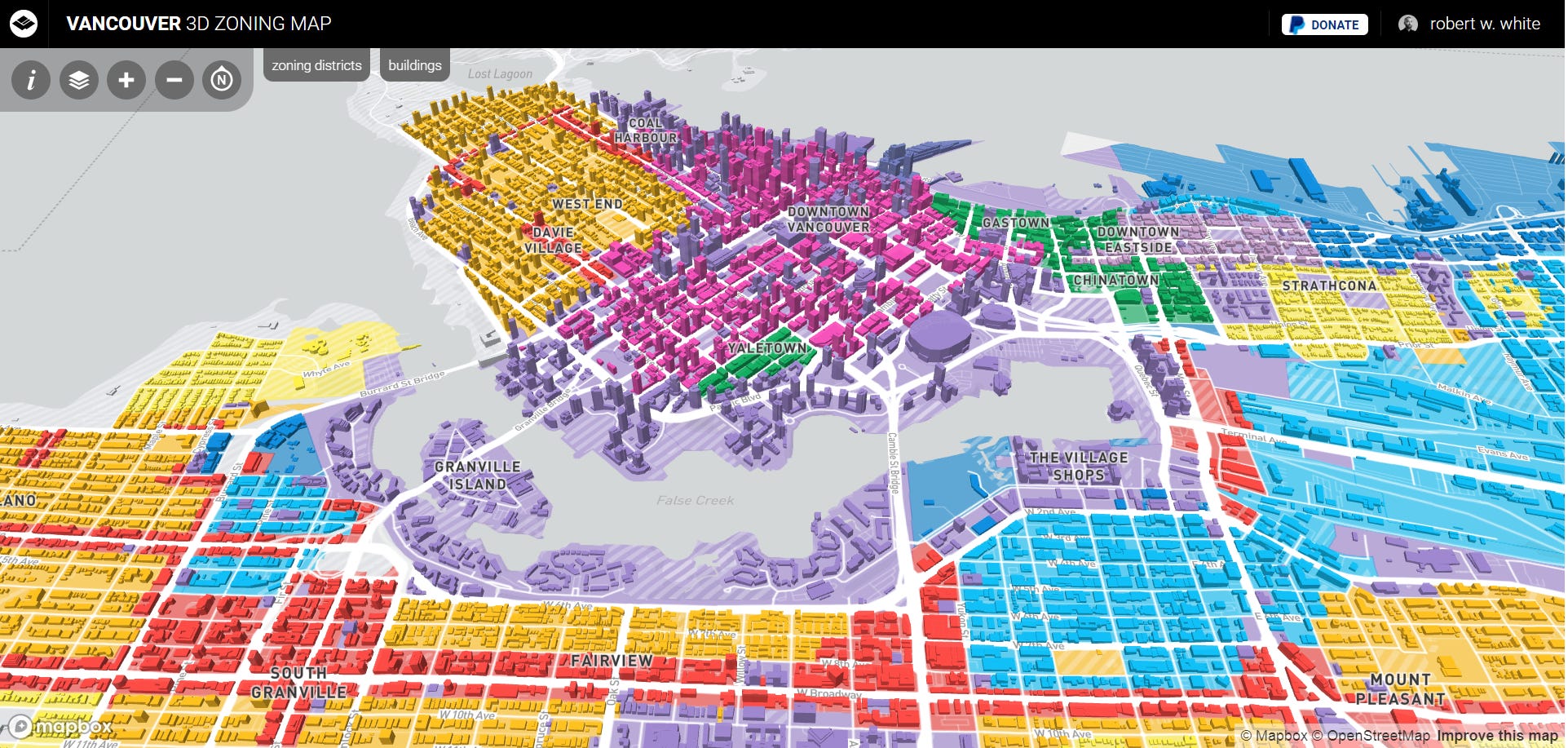
Vancouver 3D Zoning Map, by Robert White. From the information page:
Vancouver is divided into different zones which describe the details of permitted development, use, and so forth. If you've ever tried to figure out what the specific zoning district is in a specific part of town (like your home), you'll know it can be a bit tricky. That's where this map comes in!
The building (2009) and zoning (2021) datasets are from the City of Vancouver's Open Data Portal. To learn more, check out the City's Zoning and Land Use Document Library. I used Mapbox to pull it all together with some custom styling and interface work, making use of their amazing new extrusion properties.
I occasionally make updates and improvements, but please get in touch if you have questions/comments @rbrtwhite.
More
A map I find really useful: Jens von Bergmann's Vancouver Assessment Map. Provides assessment values on a parcel-by-parcel basis, along with a ton of other information - building age, zoning, etc. Cheat sheet by Reilly Wood.
Vancouver zoning map by Reilly Wood: it’s illegal to build apartment buildings on most of the residential land in the city of Vancouver. Why does Vancouver have 895 zoning districts?
Vancouver assessment map by Edmonton’s Darkhorse Analytics.
Cities Skylines, Vancouver edition!!! I would love to see the zoning map for North Van. Really makes me angry that anything other than SFH there are allowed only on Longsdale or close to the coast.